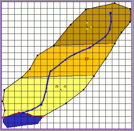
This simple basin has
a single trunk stream that drains to a lake which is also the ground-water outflow
for the basin. Sediments with fairly abrupt increases in hydraulic conductivity
illustrated by darkening color are surrounded by extremely low permeability
bedrock. Flow is generally oriented toward the stream with some components parallel
to the stream, in the direction of the lake. The southern well field and the
ranch well at the "??" have been in existence for a long
time. A new well field is proposed in the north and the concern is what impact
this will have on the ranch well.
A very simplistic grid would be oriented north/south and have large uniform
cell sizes (in this case 20x20). Many of the cells would lie outside of the
model domain. Hydraulic features and boundaries would be placed in the grid
cells in an approximate manner.