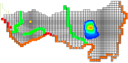
This example is a demonstration model for GMS. This
is a plan view of a 2 layer model. Each grid cell has one value for each relevant
material property and one value of head, flow, and concentration associated
with it.
The north side is no-flow due to the presence of a low permeability rock. The orange dots indicate a river boundary. The green spots are drains representing intermittent streams. The yellow area represents wells. The plume emanates from a landfill.
LAYER 1 Click
on the map to animate the transport output
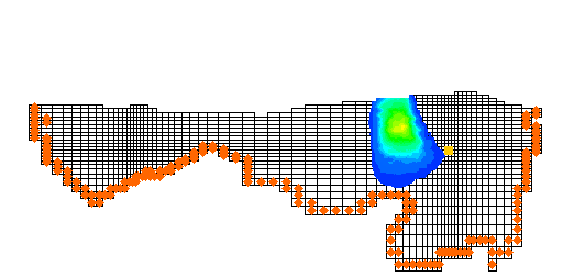
LAYER 2 does not cover the entire area
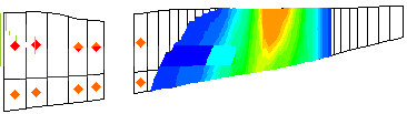
Cross section through the plume
This is an example of the movies you can make directly with GMS (Ground Water Modeling System) or by incorporating model output into other movie making software.